KM 0 · START
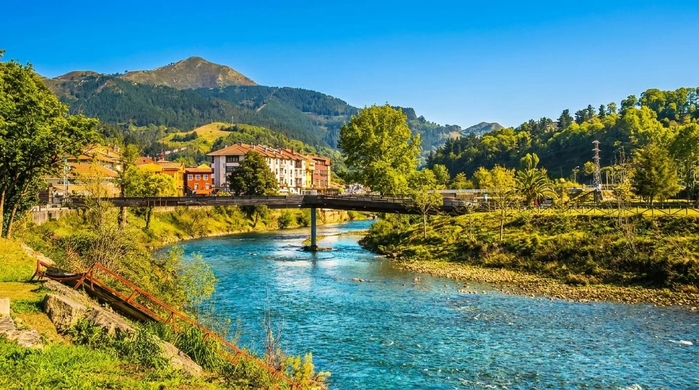
Arriondas
Starting point
Where it all begins. Check-in at our offices, gear and mini-class before getting in the water. Capital of the Parres district.
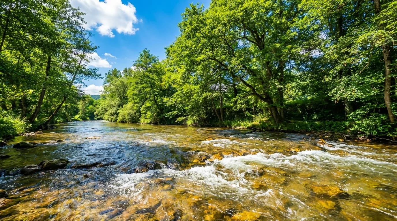
The Sella River canoe descent covers 14.5 km between Arriondas and Fríes, crossing Asturian villages, gentle rapids, historic footbridges, river beaches and 6 riverside snack bars. Here is the interactive map with every point along the way.
Hover over any point on the map to discover rapids, riverside snack bars and footbridges.
Starting point
Where it all begins. Check-in at our offices, gear and mini-class before getting in the water. Capital of the Parres district.

First rapid
The first gentle rapid of the way — moderate class I. All you need is to paddle calmly: the river guides you.

Two iconic stops
The first riverside snack bars where people stop for a drink or to cool off. Lively atmosphere in high season.
Salmon fishing reserve
You cross the historic salmon fishing reserve of Los Llaos. Asturian villages on the banks, holm oaks and beech woods. One of the most beautiful stretches.

River beach
Calm waters and river beach. An ideal stop for a swim — especially in July and August when the water is warmer.

End of Mini Sella
Pick-up point for those choosing the Mini Sella. Whoever continues to Fríes crosses the most open part of the valley.

Mid-journey
A usual stop to rest or to cool off before the final stretch. Spectacular sunsets.
End of Full route
End of the Full descent. Our transfer picks you up and takes you back to Arriondas. Changing rooms with hot showers await.
The Sella River canoe descent was born in 1929, when three Asturians — Manés Fernández, Dionisio de la Huerta and Benigno Morán — paddled down for the first time between Coya and Arriondas. Today, the tourist route between Arriondas and Fríes still keeps each historic landmark of the river: gentle rapids, footbridges, river beaches and unforgettable stretches. This is the complete guide, spot by spot.
Starting point of the descent. You set off from our ramp over 35 m long or directly from the bank, next to the legendary Puente de las Piraguas (Canoeists' Bridge) — the same bridge where every August the official start of the International Descent is given.
The first rapid of the day. The current speeds up and the river narrows. Moderate class I — passed without trouble, the canoe gains some speed and gives you the first thrill.
Second rapid with V-shaped waters. The only important thing is to stay centred between the two converging currents — a fun push.
A narrower stretch with calm meandering waters. Historic salmon fishing reserve — you will find anglers on the banks during the salmon season.
You pass beneath the footbridge of the parish of Triongo (Cangas de Onís). Second salmon reserve and one of the most beautiful stretches of the river — Asturian villages on the banks, holm oaks and beech woods.
A stretch full of small rapids and stones. On the right bank stands a ruined breakwater that is part of the historic river landscape.
One of the favourite spots of the route. Calm, deep waters, a river beach ideal for swimming — a must-stop in July and August when the water is warmer.
Marks the border between Cangas de Onís and Ribadesella, in Margolles. Small rapid on the right bank that reminds you the river is still alive.
End of the Mini Sella. After about 2 hours of paddling, calm waters and two snack bars on the bank. Our transfer picks up from 2:30 pm those who choose the short route.
Spectacular and very rocky stretch. One of the most exciting moments of the Full descent — intense class I, always safe with a certified life jacket and the previous mini-class.
The longest straight stretch of the route, with very deep waters. Perfect time to paddle at your rhythm, enjoy the open valley and chat without surprises.
A usual stop to rest on the bank or cool off before the final stretch. Wide banks and spectacular sunsets if you come down in autumn.
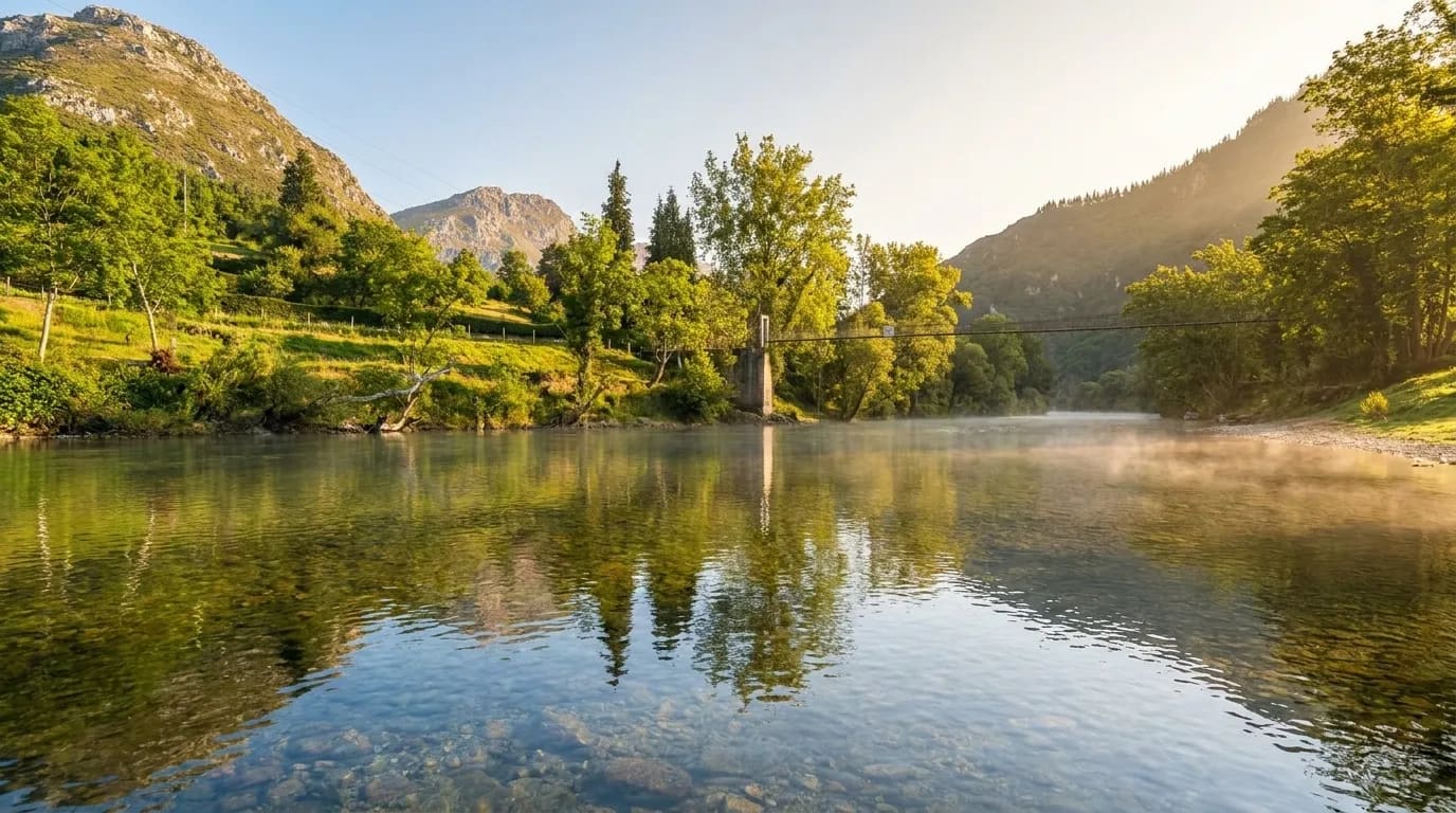
A village in Ribadesella famous for its natural cave. The footbridge over the river is a pedestrian and anglers' access — a very photogenic stretch.
The last footbridge of the route. From here the river calms down, more river beaches appear and the valley opens gently towards the sea.
End of the Full descent. Between 3 h 30 and 4 h 30 from Arriondas depending on pace. Our transfer picks you up and takes you back to the offices, where changing rooms with hot showers are waiting.
Along the route you can stop at any of the 6 riverside snack bars on the banks of the river — to cool off, eat or simply rest before keeping on downstream.
Both start from the same place (Arriondas) and share the first 7 km. The difference: where you finish.
The short stretch. Ideal for families with small children or half a day. Ends at the Toraño snack bar, with pick-up from 2:30 pm.
See Mini Sella detailThe full classic experience. More kilometres, more landscape, historic footbridges and river beaches all the way to Fríes. A full day on the river.
See Full route detailThe Full descent is 14.5 km from Arriondas to Fríes. The Mini Sella, the short option, is 7 km between Arriondas and Toraño. Both share the same initial stretch.
The descent starts in Arriondas (Asturias), at our offices. The Full route ends in Fríes after 14.5 km. The Mini Sella ends earlier, in Toraño (km 7). In both cases our transfer picks you up and takes you back to the starting point.
There are 6 riverside snack bars along the route: Riverland (km 1), El Oasis and El Prau (km 3), El Bosque and La Mediana (km 4) and Toraño (km 8, end of the Mini Sella). You can stop to rest, have a drink or simply enjoy the atmosphere.
Yes. The most well-known is Pozo del Arco (km 6), with calm waters perfect for a swim. There are also several informal banks and beaches along the route — especially after Pasarela de Fuentes and before Llordón.
The Sella in its tourist stretch is gentle river — not white-water. It has some moderate class I rapids such as La Raíz (km 0.2) and La Remolina (km 1). With the previous mini-class and a certified life jacket they are done with total safety.
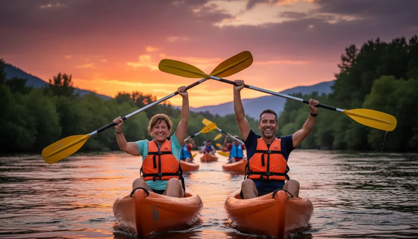
Yes, you set the pace. You stop wherever you wish: at river beaches, snack bars or simply on the bank to stretch. The only thing to comply with is the maximum permanence until 6:00 pm by regulation of the Cantabrian Hydrographic Confederation.
Both share the first 7 km (Arriondas → Toraño). The Mini Sella ends there — ideal with small children or for half a day. The Full descent continues another 7.5 km to Fríes, adding open landscape, the Cuevas footbridge, the La Uña footbridge and the closing of the valley. More detail on times here.
Asturian villages (Fuentes, Margolles, Toraño, Cuevas), Cantabrian forest with holm oaks and beech woods, 6 snack bars on the banks, the salmon reserve of Los Llaos, river beaches, gentle rapids and several historic footbridges. The most scenic plan in Asturias.
You already know the 14.5 km, the snack bars, the stops and the highlights. Choose a date and book without paying now — pay by card or the day you pick up the canoe.
Necessary cookies are always required. Analytics and advertising cookies are only enabled if you accept them — they help us improve the site and measure whether our ads work. You can reject or customize your choice.
Read cookie policyChoose which cookies to allow. Necessary cookies are essential for the site to work. The rest are optional.
They enable navigation and the basic functioning of the site. Without them the website cannot operate. They do not require consent.
We measure visits anonymously and in aggregate (Google Analytics 4) and analyse how the site is used via anonymous heatmaps and session recordings (Microsoft Clarity) to improve content and user experience.
It lets us know if our ads work — whether a click on an ad ends in a booking. Data without identifying you.
Allows Google to receive aggregated event data to optimize ad performance.
Lets us show you more relevant ads based on your interest (for example, if you have already visited our website).
In compliance with GDPR, LOPDGDD and LSSI-CE art. 22.2. You can change your choice at any time via the "Cookie settings" link in the footer. More details in the Cookie Policy and the Privacy Policy.